해수부_지오스토리 SeaHwak CZMIL(Coastal Zone Mapping and Image Lidar) System 공…
페이지 정보
작성자 lvitech 댓글 0건 조회 32,756회 작성일 20-01-29 11:11본문
해수부_지오스토리 SeaHwak CZMIL(Coastal Zone Mapping and Image Lidar) System 공식 유지보수업체 지정 협약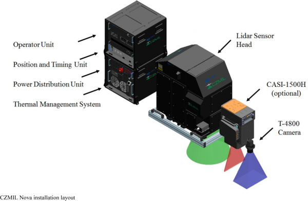
CZMIL (Coastal Zone Mapping and Imaging Lidar) bathymetric
The Coastal Zone Mapping and Imaging Lidar system (CZMIL) is an integrated lidar-imagery sensor system, and its complementary HydroFusion software suite is designed for the highly automated generation of physical and environmental information products for mapping the coastal zone. CZMIL is designed to survey over a wide range of water types, ranging from moderately clear to predominantly turbid.
공유자료
 RPMC
RPMC Northrop Grumman
 Synoptics
 Bright Solutions
 Optoman
 SCANLAB
 ASLD
ASLD DPSS Lasers
 Access Laser
 Arete
Arete LASERLAB
 Holmems
 Prospective
 OminiSensing Photonics
 Beamera